By Sarah Sarfaty, AEMT, FAWM
Recently, I had a couple of free days down in Zion National Park before teaching our annual WLS:MP course in the area. I decided to use my free time for canyoneering and set my sights on running the Subway. To make this dream a reality, there were some logistics required.
The Left Fork of the Subway is one of Zion’s more popular canyons that require a permit. There are two ways to explore this canyon: Top Down or Bottom Up.
- The Bottom Up route is a strenuous 9.5-mile out-and-back hike that starts at the Left Fork Trailhead and terminates about halfway up the canyon.
- The Top Down option is a through hike that requires technical canyoneering skills. The route starts at the Wildcat Trailhead and ends at the Left Fork Trailhead. To safely do this hike, ropes, wetsuits, and a shuttle are required. This was the route I chose to do.
There are two different ways to obtain a permit, the seasonal lottery or the daily lottery. The seasonal lottery is open several months in advance; the daily lottery is open two days in advance. Fortunately, given that there is a much lower interest in running this canyon in November than at other times of the year, I obtained a permit from the two-day lottery. I had to go to the park the day before to pick up my permit; the National Park does a fantastic job outlining all the risks and requirements for any adventure within their boundaries.
One of the main reasons interest in the Subway decreases once it gets cold is due to water in the canyon. It is rated a 3BIII.
- 3: Technical ropes are required
- B: There are pools of water with little to no current
- III: About a full day of travel
Simply put, the Subway requires swimming and the water is COLD. Wetsuits were required, with other people running the canyon on the same day choosing dry suits.
The route starts with a poorly marked hike to the canyon with a steep downclimb.
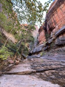
Image 1: a slick rock section of the trail with no route marked
Image 2: the canyon entrance, about halfway down the trail
From there, change into wetsuits and navigate through the narrows section. There are downclimbs, wading, pools for swimming, and two defined rappels. The last rappel marks the end of the canyon section and from there, the route is the same as the Bottom Up.


Image 1: The final rappel
Image 2: The Subway
The hike navigates through the canyon, crossing the stream, going around boulders and pools, and ends in a steep climb out (400 ft of elevation in 0.5 miles).

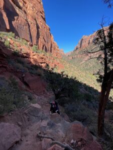
Image: The hike out
My stats for the canyon:
- Total Time: 8.5 hours
- Total Distance: 11 miles
- Rappels: 2
- Swims: 4
- Experience: 10/10
I don’t often explore National Parks in Utah. As a resident for the past decade, I’ve been able to find my own areas of interest that are less crowded, less expensive, but equally beautiful. This was my first time in a National Park in Utah and I feel that I set the bar really high.
The hike was beautiful, the location still felt remote, and the canyon was a great way to experience a part of the Subway that very few people get to see. This whole experience was made possible because it was a work trip (A huge thanks to Dr. Dave Della-Giustina, lead instructor and primary author of WLS:MP for giving us a very early morning shuttle ride).
Traveling for work can be taxing but in this case, it was certainly worth it.

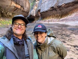
Image 1: Allie and I after changing out of our wetsuits

